New mapping tool maps age of every building in Manhattan
Map geeks and history buffs, rejoice!
Ever wanted to know where to find the oldest buildings in Manhattan? Wondering when the building you’re living in was built? Now you can find out, thanks to the inventive folks at Morphocode. Morphocode is an architectural firm that works “at the intersection of design and technology.”

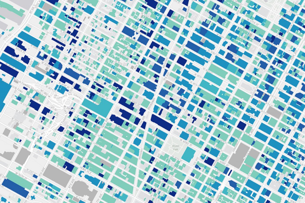
Urban Layers maps the age and location of Manhattan buildings. From Morphocode.
They created a program called Urban Layers. Urban Layers is a mapping tool that combines historical information and street maps to offer a rarely seen level of insight. Here’s how they did it: First, they tapped into two existing data sets. The first data set, PLUTO, “contains various information about each building in NYC: year built, height, borough, etc.” The second data set, Building Footprints, provides (you guessed it) the building footprint for each building in the city.
They blended this data to determine the year built for each building, and attached this information to advanced vector technology called Mapbox GL JS. The result: an incredibly detailed map featuring massive amounts of architectural history.
The team at Morphocode admits that the technology isn’t completely perfect, because the data sets themselves aren’t completely perfect. They suspect that some of the building records are off, but it’s still an impressively-comprehensive, user-friendly tool.
Urban Layers is more than just a map. It’s highly interactive. Users can essentially watch the city evolve by using sliders to scan through the years and identify the city’s oldest buildings. The first buildings were constructed around 1765, but of course, those aren’t lining the blocks any more. You’ll see the country’s most famous island go from sparsely populated to a densely-packed urban landscape in the building boom of the 1810s through 1900. You’ll see that most of the current buildings were constructed between 1900 and 1940.
Kriston Capps spent a good amount of time playing with Urban Layers for his feature in City Lab. He was particularly fascinated by watching the Harlem Renaissance unfold. And in spite of the incredible amount of information, Urban Layers is likely to spark as many questions as it does answers. As Capps digitally toured the city, he wondered, “Why did it take New York so long to build up around Central Park after its completion in 1857?” “Is the rise of much of modern Manhattan related to the formal consolidation of the five boroughs?”
If you happen to be in the Big Apple, you could use Urban Layers to identify the oldest buildings, note their locations, and take yourself on an architectural tour in person. And yet, the beauty of this technology is that people from Iowa to Singapore can “explore” New York. And then, of course, keep searching to find answers to those inevitable questions.
So…if you need us, we’ll be taking a virtual tour of New York.


